Friday, June 19, 2009

Kurt's Hikes Has Moved!

Kurt's Hikes can now be found on Blue Ridge Country's newly redesigned website:

http://www.blueridgecountry.com/blogs/kurts-hikes/

The blog has gone on to win second place in web writing at the national level from the National Federation of Press Women, a continuation of competition from his first-place win announced below.

At BRC.com, you'll also find RidgeLines, a new blog written by Blue Ridge Country's editor Cara Ellen Modisett:

http://www.blueridgecountry.com/blogs/blue-ridge

...and coming soon will be Word & Image, a blog written by the following guest contributors:

novelist Sharyn McCrumb
Gerry Bishop, retired editor of Ranger Rick magazine
author Su Clauson-Wicker
BRC contributing editor Deborah Huso
BRC environmental reporter Cathryn McCue, on staff with the Southern Environmental Law Center
BRC food columnist Fred Sauceman
BRC contributor Marla Milling
author Jeanne Mozier
photographer Rebecca Armstrong
photographer Frank Ceravalo
photographer Joe Rossbach
writer Lynn Seldon
writer Peter Slavin
writing/photography team Phyllis Speidell and John Sheally

See you at BlueRidgeCountry.com!

Thursday, May 21, 2009

Kurt's Hikes is Moving!

First of all, congratulations to Kurt Rheinheimer - this blog has won first place for web writing in the Virginia Press Women's annual competition, and goes on to national competition (results to be announced in the fall).

In addition, Kurt's Hikes is migrating to BlueRidgeCountry.com - we are in the process of launching our new web design, including this blog and others. You can find future entries here:

http://www.blueridgecountry.com/blogs/kurts-hikes

So be sure to follow Kurt and Gail's continuing adventures on the trail.

Thanks for reading!

Wednesday, May 13, 2009

The First Short-Sleeves Day of the Year... Without a Map


April 18, 2009. Hoop Hole upper and lower loops. 9.0 miles.

With guest-dog Fluff along in addition to puppy Cookie, we returned to a hike in Botetourt County not too far from where Fluff would lie his head for the night. The Hoop Hole trails, east of Eagle Rock and with multiple stream crossings, are a favorite of dogs, both because of the water and, especially before the leaves return, the openness of the forest - allowing for occasional stops to peer for deer.

For the human hikers, it was the first shorts-and-short-sleeves day of the year, and with the streams in good flow and the sky mostly blue, it was truly all good. Well, except for maybe the 2,400-foot climb, the pesky narrowness of the trail along several steep-slope spots and that false-summit of Pine Mountain that we'd both forgotten, about a half mile before you reach the true peak, at 3,700 feet. And a bunch of big-gnat type flyers who didn't bite or sting, but sure loved to crawl around on things and seemed to want to share our lunch spot on the summit.

Then too there was the reiteration of one of the basic tenets of any hike: Take the map! Even on a most-familiar hike! Our failure to do so led us maybe half a mile down the side trail toward Roaring Run before we returned to our senses and went back up the hill to the main trail, grumbling to each other about our collective stupidity. It's odd: You're out there to walk (and walk and walk), but stick in an accidental mile extra and big bad hikers get cranky with themselves. The dogs, on the other hand, didn't mind a bit.

And they loved the many more easy stream crossings on the way down to the car.

Monday, April 27, 2009

Summiting Terrapin Mountain, and Rock-hopping with a Nervous Puppy


April 11, 2009. Terrapin Mountain Trail/Reed Creek Trail loop. 9 miles.

We'd been trying to get back to this hike – done years ago and only vaguely remembered – for weeks, owing to Gail's hope to pass by the old homeplace of a friend/co-worker who grew up on the side of Terrapin Mountain, in Bedford County. Alas, the little piece of paper with the directions to it were remembered only after some miles of driving into Bedford County, so we'll get to go back to this pesky down-up hike again sometime before too long.

Actually the walk starts up, for perhaps a quarter mile, to reach the summit of Terrapin Mountain before beginning a long, rocky, occasionally steep descent. At the end of the nearly three mile drop, the Terrapin Mountain Trail intersects with the Reed Creek Trail, and things get considerably easier; the trail makes its away gently along near the bottom of the mountain, curling its way around and into ravines on its way to Reed Creek.

We ate along one of the bends, in the semi-sunshine on a rock. (And found out, a day or so later, what we have had to relearn every daggone year in the woods: It gets to be April? And warm? You need to get the trusty ground cover out and sit on it for lunch, or else – come Sunday or Monday – you'll have these big ol' itchy welts on your backside. Duh.)

It was at the first crossing of Reed Creek, on this spring day when the water was spilling furiously over the rocks, that we had our adventure for the day. Gail and I had to walk upstream a good ways to find a set of rocks, boulders and logs that were close enough together to let us hop across. But alas, puppy Cookie – seven and a half months old and a fine leaper on dry land – wanted no part of the last boulder-to-rock jump. And so we scouted farther up but to no avail, with the dog yelping more and more desperately with each passing, separated-from-momma moment. At last, back where the trail crosses on small rocks at lower water levels, The Greatest Puppy Helper took off her shoes to wade the dog across. Halfway, with the woman yelping from the cold and the dog from fright, Cookie wrestled her way out of her collar rather than go into water well onto her belly. The second try, with the collar tighter, was a success, and the little half-hour challenge was done.

The trail turns, a half mile or so up, across the stream again. And while we did have to scout a bit again, we soon found a crossing all three could readily make. From there, it was on up the rest of the mountain back to the starting point, on what is, despite its climb-at-the-wrong-time, a nifty walk.

Tuesday, April 21, 2009

Honoring Wilderness, and Audie Murphy


April 4, 2009. Appalachian Trail, Va. 620 to Audie Murphy Monument and back. 7.6 miles.

We picked this walk on this day in honor the signing by the president of the omnibus outdoors bill, which includes the creation of a new designated wilderness along its route – Brush Mountain East. The new protected area is one of seven new wildernesses bought into being by the Virginia Ridge and Valley Act, which protects 43,000 acres as wilderness, and also creates more than 10,000 acres in two new National Scenic Areas in Virginia. That bill, versions of which go back as far as 2004, was sponsored by both Senators Webb and Warner in the Senate and had sponsorship or contributions from Representatives Goodlatte and Boucher in the House.

The good climb up from the low point at Trout Creek along 620 was of course no less steep by virtue of the new designation, but the approach from this direction does get you on the ridge line sooner than from the other way up, allowing for a pleasant and easy second half of the walk to lunch.

The monument to the fallen war hero is more decorated every time we visit it, with more and more intricate cairn work off to the side, and more and more flowers (artificial for sturdiness), flags and other leave-behinds all around the stone marker. We scouted around for the perfect lunch spot on both the east and west sides of the ridge and ended up, as is The Day Hiker's wont, on the east – in the sun and not in the wind. Frisky puppy Cookie was tired enough to allow us a brief nap before we started back through the woods with just a touch of new meaning to them.

Wednesday, April 1, 2009

Following in Thomas Jefferson's Footsteps


March 29, 2009. From Blue Ridge Parkway milepost 83.1: Fallingwater Cascades Trail loop and Flat Top Mountain up and back. 7.2 miles.

This two-walk walk is a good one for an early-spring, post-rain trek, given the presence of falling water, moist spots for early wildflowers and the open, pre-leaf views going up 4,001-foot Flat Top.

All three perspectives provided at least some reward on this brisk, increasingly blue-sky day. The falls had a healthy, noisy flow. The Greatest Day Hiker Of Them All paused maybe 20 times during the walk to move leaves, inspect new shoots and occasionally quiz her hiking companion, who was maybe-two-of five on identifying. And on the way up, views onto Harkening Hill to the west and out onto the piedmont to the east were frequent.

The walk up the mountain that the AT guidebook talks about Thomas Jefferson climbing at age 72 is a rewarding one – nicely switch-backed till near the top, where things get rocky and steep, and where there are several faux summits before you reach the terrific views from both the western and eastern rock outcrops at the true summit. One of those false summits was recommended to us pre-hike by son Carl, whose propensity toward photographic memory for hikes manifested itself with the advice to look out for Pinnacle Rock and its gnarly old evergreen, which we did find.

At the true summit, The Day Hiker and her rock-rookie puppy headed immediately for the eastern overlook; I took a quick view westward before joining them on the eastern overlook, where we were surprised to have the big rock to ourselves on this pretty day. Cookie explored it to every edge and precipice, causing her mistress to reach the edge of panic several times.

The air was sufficiently clear to see the city of Bedford fairly clearly. The Bedford reservoir is the most immediate and prominent feature of the view. To the north, Apple Orchard Mountain is prominent, and to the south, Sharp Top's sharp, rocky top is clear and imposing (though about 125 feet shorter in elevation than Flat Top).

On the walk back down, six-month-old Cookie confirmed her readiness for full-distance hikes with a sustained friskiness that manifested itself in off-trail runs and explorations, and in a half-mile or so of repeated taking of Gail's hiking pole into her mouth, to the extent that for many steps at a time, the pole served as sort of a stiff, voluntary leash for the wacky puppy.

Friday, March 27, 2009

In Search of a Tunnel


March 21, 2009. Carvins Cove Boat Launch Lot to Tinker Creek tunnel and beyond on the fire road on the northern side of the reservoir, and back. 8 miles.

This walk was occasioned by the previous week's, when we crossed Tinker Creek on the Appalachian Trail just south of U. S. 220 at Daleville. The creek, fed by the weekend rains, was fuller than we'd ever seen it, rushing its way south toward Roanoke and into the Roanoke River.

The next day in the Roanoke paper was a piece on the status of area reservoirs, in which an official from the Western Virginia Water Authority talked about Tinker Creek continuing to help replenish Carvins Cove. I was puzzled enough to get out the topo map and verify that Tinker Creek flows along one side of formidable Tinker Mountain, and Carvins Cove is on the other, with no visible connection whatsoever to Tinker Creek.

The explanation, with specifics courtesy of Sarah Baumgardner at the water authority: a 6,528-foot, six-foot-diameter tunnel through the mountain.

So our goal for this hiking day became a walk to see where "Tinker Creek" spills into Carvins Cove.

The Brogan tunnel was completed in 1966 and is operational as a reservoir-filler only when Tinker Creek has reached a specified level of flow; thus the continued strong rush of water – far downstream from the tunnel – that we saw where the creek passes under the AT, even as water was being diverted into Carvins Cove as well.

The walk to the mouth of the tunnel is along the fire road. We've done this stretch several times on bicycles – on the way to the Sawmill Branch Trail up to the AT – and agreed it is much more pleasant on foot; its climbs are clearly minor when you walk – think of a climb up Tinker Mountain on the AT or on the Andy Lane, for example, versus little hills along Carvins Cove. (We threatened, on our last ride of the road, to chuck the bikes into the reservoir upon finishing.)

With new-hiker Cookie the five-and-half-month-old puppy in tow, we made good time on the approximately 1.7-mile walk to the point in the road where there is a left to head down to the water. It is at the end of this road – less than a quarter mile – that the tunnel empties into a semi-circle-shaped concrete bowl that creates a short falls as the water spills over and on into Carvins Cove. At this spot as well as at smaller feeder streams along the way, the reservoir was taking on serious water, apparently replenishing still, a week after the rains.

There are suggestions of a trail along the perimeter of Carvins Cove, and we walked along those and at times along the bank created by low water until we found a good sunny spot for lunch. From there, we followed a small stream up from the edge of the reservoir, back to the road and back to the parking lot.

Tuesday, March 24, 2009

Tiny Trail Magic

March 15, 2009. Appalachian Trail from U.S. 220 southbound to first full viewpoint of Carvins Cove and back. 6 miles.

With rain all weekend and grandkid commitments here and there, we snuck in an old favorite and got lucky not to catch any drops during the two hours we were out; this was late Sunday afternoon and the first two dry hours all weekend.

Not that there weren't good evidences of all the rain that had fallen. The lower part of this trail section seems always to be muddy, and on this day it served in spots as a little brook bed. And Tinker Creek, usually languid where the trail crosses it, was in a discolored rush on its way toward Roanoke and the Roanoke River. Higher up, just prior to where the trail attains the ridge line, we heard the sound of water off to the left, over on another piece of Tinker Mountain. A little farther along, we were able to see where the sound was coming from – a 40-foot rain-fed waterfall over an outcropping. In perhaps a dozen walks on this section over the years, we'd never seen nor heard water over there.

At the ridge line, we entered the light fog of cloud cover, but could still see down to the surface of Carvins Cove when we got to the outcropping of "Hey" Rock (not Hay Rock, but the one where you go, "Hey, there's Carvins Cove"). Even though this was a good weekend for the drought-ridden reservoir, the broad band of tan around it was still starkly evident through the mist.

After we were back down the mountain and back to real life, showers returned, and we counted ourselves lucky to have been visited by yet another, albeit tiny, piece of trail magic.

Wednesday, March 18, 2009

The Puppy's First Hike


March 7, 2009. In Carvins Cove Preserve, up the Hi-Dee-Hoe Trail to Brushy Mountain Trail to Carvins Cove overlook and back. About 7 miles.

We'd planned for something longer, but with no sitter for puppy Cookie, the five-month-old lab/boxer/pest mix, we opted to make this day's walk both shorter and also Cookie's first genuine walk in the woods.

The Carvins Cove trail system, with its ski-style signage for the bikers, is nothing less than a terrific near-urban resource, and on this summer-like day, there were ample members of all three user populations – cyclists, horse riders and hikers – out and about on the land. We went in from the Va. 311 side, where you have to stop for your hall pass ($2 per day or $20 per year) at the Just The Right Gear bicycle shop before you park in the lot along Bennett Springs Road.

The Hi-Dee-Hoe begins innocently enough, crossing a feeder stream and meandering briefly in the woods before heading up the mountain with a series of climbs and switchbacks, tightening to steeper gradations as you near the top – to the extent that the trail carries a black diamond and a caution on the map about climbs. Still, the puppy, The Day Hiker and I made the climb – a mile and a half or a little more? – with relative ease, with Cookie pausing for quick snowcones at spots on northern faces as we neared the top.

The Brushy Mountain Trail into which the Hi-Dee-Hoe Ts is a wide old forest road that at this pre-leaf, pre-weed time of year looks like a dirt-track thoroughfare compared to a traditional trail. The three walkers could spread out every which way across it, save for the occasional meeting of cyclists or other hikers. One such meeting included the presence of a seven-month-old puppy; attraction and play were immediate and the older dog got the first take-down in the brief wrestlin match there in the dust.

We ate lunch on a knob with a semi-view down onto Carvins Cove, which continues to be seriously tan-rimmed in the ongoing drought. The dog did some preliminary sniffing, scouting and woofing as if to secure the space and after we ate, there ensued an uncharacteristic hour: The dog, just a puppy, and the big kids, both mildly under the weather at the start, all lay down on the woods floor and took a nap, another factor in which may well have been the first shirt-sleeve day in many months.

We joked that the puppy's bones might turn to jello before we got back down, with this walk about double her previous single-walk distance. But Cookie had more energy than even The Greatest Day Hiker Of Them All on the easy, if long-for-its-mileage return walk.

Wednesday, March 11, 2009

Snow Day!


March 1, 2009. Appalachian Trail from Va. 620 northward onto Cove Mountain and back, including a stop at Pickle Branch Shelter. About 6.5 miles.

We set out on this day of impending snow to try to find some actual snow to walk in before its predicted arrival in Roanoke-proper long after dark. We wanted a western-facing ridge to walk on, and chose an Appalachian Trail section west of Roanoke. We parked where Va. 620 crosses the trail, heading for the Audie Murphy Memorial 3.8 miles southbound. But as seems to have befallen us once before at this spot, we realized, once we saw the distance sign maybe an eighth of a mile in, that – duh – we were headed the wrong way. Still, Dragon's Tooth at 4.0 miles away, seemed equally fine, and we HAD gone that eighth of a mile, so we continued southbound.

Snow began falling – lightly – after perhaps a quarter mile in. And as we continued to climb, it got stronger and steadier, to the point that by the time we passed the Pickle Branch Shelter spur at about a mile, the forest was quickly filling with white, and visibility was decreasing delightfully. The Day Hiker paused us here and there to look at tracks in the snow – everything from little-bunny hops to big-deer leaps. By the time we reached the ridge line of Cove Mountain, the snow came still stronger, and at times with an almost fully horizontal angle, as the openness to the west that we had sought did indeed serve to deliver the weather. And views to the east and west off the ridge were – well, they were a gray-white wall perhaps 50 feet out.

Our hopes to walk to Dragon's Tooth soon got buried in the wind and snow: Even with good layers, several sets of gloves and hats, we realized that lunch was going to present a challenge in terms of comfort and shelter from the storm, even amid all the big rocks – the "false teeth" along the ridge before the primary formation. And so, after a few pauses and decisions to push on, conditions finally turned us around – sending us back down the mountain and toward the shelter for lunch.

We'd never been to Pickle Branch Shelter before, as its one-mile-in-from-parking rendered it a too-early or too-late stop. But on this day it provided the perfect spot to pull off wet top layers, change socks and gloves, and settle into a comfortable lunch looking out into a forest filling with snow. It's easy to forget, when it's been so long, how quiet and white and peaceful a real snowfall is. And while we have walked through fallen snow many times before over the five years that we've been heading out, this was our first full falling-snow hike.

The snow tailed off as we drove down out of the mountains. But back in Roanoke was evidence of an inch or two that had fallen while we'd been out. The real snow in the city came after midnight, and we awakened to a total of six inches or so, making for more opportunities to walk in the white, albeit urban ones.

Sunday, March 8, 2009

Wilderness in the Afternoon, Fred Eaglesmith in the Evening


February 21, 2009. St. Mary's Wilderness along the river to the falls and on the St. Mary's Trail to the Mine Bank Creek Trail and back. 8.4 miles.

St. Mary's shares with Dolly Sods, Ramseys Draft and many other Virginia/West Virginia designated Wilderness areas the prominent, central feature of a narrow river gorge prone to flooding, and all of the rearranging of the surrounding area brought on by by the occasional too much water at one time. The sign at the trailhead for St. Mary's talks about Hurricane Isabelle having moved things around a bit back in 2003 and that those effects remain. Combine that with the lack of blazes on trails in Wilderness areas, and you have a walk where you get to pretend a little that you're really out in the wild. The trail along the river does get faint or seem to go in several directions at some points, a situation that creates uncertainty about where or if you need to cross the St. Mary's River, which on this day was apparently a bit lower than usual; some of the guidebooks talk about having to wade across several times, and we never did.

We did, however, at just about the same moment but at different crossing spots on our first rock-hop, both stick a shoe into the water, and both protested to the other about the total lack of necessity of it all. I had made my most difficult step when my pack hit a limb, throwing me off to the side a little and into the drink halfway up one shin. The Day Hiker didn't go in as far, but soaked a shoe when she also got a little overconfident and took her eye off the rocks for a second.

Nonetheless, the river hopping was fun, as was keeping up with the trail till we got to the falls which, while not spectacular, are a pleasing little sight at an equally pleasing site. Back down from that half-mile spur, we got back on the main trail and ascended gently through pretty forest and past several old mining sites and their slag mounds to the intersection of the St. Mary's Trail and the Mine Bank Creek Trail. With an open spot and good sun, we spread out lunch, shared a fresh pair of socks, set single shoes in the sun to dry a little and ate.

On a day forecast to get into the 50s, the air felt like it remained in the 30s even in the sunshine, and The Greatest Day Hiker Of Them All added to her reputation as a result, with an all-out assault on the trail back down – just to get warm, of course. No, we did not repeat the half-mile spur to the falls on the way down, but even with the rock hops and the slow, narrow and rocky spots on the trail, she had us back down in half the time it took us to get up.

Another reason for the hurry down was to get on to Harrisonburg, where we needed to find a room, get a shower and make our way to Clementine's in time to get a table for dinner and the ensuing live music from the incomparable, ever-touring, hardest-working man in the Americana music biz, Fred Eaglesmith, who is, by the way, Canadian. He'd been in Greenville, S.C. the night before, in Nags Head the previous night and Asheville the night before that. His hard-drivin', hard-travelin' four-piece band knocked out many of the Fred classics, including The Day Hiker's requested favorite, "Spookin' The Horses," and mine too – "Water in the Fuel." The star told his usual share of awful jokes as well, including this one:

It's late at night – like 10:30 – and a guy walks into a dentist's office and tells the dentist he's got a problem.
"Well, what is it?" the dentist asks.
"Well, I feel like I'm a moth," the guy says.
"You feel like a moth?" the dentist says. "You need a psychiatrist, not a dentist. Why in the world would you come in here?"
"Well," the guy says, "your light was on."

Friday, February 27, 2009

Kurt and Gail's Hikes: The Five-Year Mark


February 14, 2009. Apple Orchard Falls Trail to Appalachian Trail to Cornelius Creek Trail. 7.4 miles. (Fifth anniversary return to our first hike.)

On this day, the fifth anniversary of the beginning of our weekly Hikes Oddity, there was ample time and inclination to reflect on the walk on February 14, 2004 vs. the walk on February 14, 2009.

On that first day, while we had hats and gloves, we were nowhere near the gear nuts we've since become. The winter packs now carry not just a full change of upper layers (plus two or three extras), but also several intensities of gloves, ear-band style warmers as well as full hats, an extra pair of socks each; not to mention those little seven-hour hand warmers that The Day Hiker occasionally resorts to; and the fancy bladder full of ice water. But this day's weather was in stark contrast to that first day's, when several inches of iced-over snow covered the ground and for much of the walk, ours were the first human prints in the white. On this sunny day, temperatures moved to around 50, the breeze was light and there was nothing on the ground but last year's fallen leaves. Not much of a test for the gear at all.

On that first day, we ascended on the Cornelius Creek Trail, with its multiple stream crossings and its half-mile section of a significantly steep climb. On this day, as we have done most times since, we took the far-gentler Apple Orchard Falls Trail up. On that first day the falls were significantly fuller than they were on this day, when we could hear ourselves talk just fine.

On that first day, a walk of about seven and a half miles was a daunting thing - something that rendered us proud enough, when we were finished, to go out again the next week. And the next and the next and... The Greatest Day Hiker Of Them All has over the five years toughened us so thoroughly as hikers that the walk now feels more like a pleasant visit with an old friend than a challenge. In fact, with a late start and an early dinner reservation, we'd have been running awfully tight back then, and Gail would have worried. And not just about time, but about darkness and maybe bears. For years now, she has rooted for bears as hard as she roots for sunshine on winter days. And on this day, she talked about the time only when I brought it up, and had us out of the woods a half an hour before my projected time – on a day when she did not feel particularly well.

In that realm, it could be noted that over these 260 weeks, there was only one - of the 13 total we missed - that was because of The Day Hiker, and even that was only half her responsibility. Eleven were for a knee or achilles of mine; one was to move a son to Philadelphia; and one - just one - was a weekend when she felt badly enough on Saturday to vote to wait till Sunday and on Sunday I felt badly enough to vote that we should have gone on Saturday.

Total mileage for the five years is 2,425.5. Longest hike is 19.3 in Northern Virginia into Harpers Ferry. Shortest is 3.4 up and down the Star Trail here in Roanoke. Among the scores of points of true exhilaration over the five years, two stand out from the most recent year: walking to just under 10,000 feet on Oregon's Mount Hood and finishing the 546 miles of the Virginia Appalachian Trail last summer on a glorious day that included the Mount Rogers summit, friendly ponies and a perfect precipice for lunch.

May our luck and will and health continue to allow us to continue to spend a part of our weekends in the woods.

Wednesday, February 18, 2009

A Warm-Weather Trail Party

February 7, 2009. Appalachian Trail from Va. 311 north on the Appalachian Trail to McAfee Knob and back. 7.6 miles.

On the warmest day of the winter to date, pretty much everybody and his hiking buddy or honey squeezed into the lot where 311 reaches its highest reach on Catawba Mountain – to the point that more cars were parked along the side of the highway down toward Salem. And it makes for a different kind of hike when this many people are out – a sort of linear party full of greetings and exchanges on the weather, the trail, the summit and, in the case of one older couple, a deep lament at all the fair-weather walkers. "We were going to be out here ANYWAY – no matter the weather," the lady asserted. No, it wasn't Gail and me; we enjoyed all the company this day, including fellow Leisureite James Richerson, his wife and a few pals from middle school making their first trek up to the coolest overlook in the area.

The precipice was literally covered with people – nearly all twenty- and thirty-somethings with cameras and cliff-edge poses to go into them. We ate lunch on the far end of the formation, looking down onto Roanoke and across the valley to Brushy Mountain. The Greatest Day Hiker Of Them All spent a considerable amount of time asking about various puppies' ages, toward the day when little lab-mix Cookie – now up to 29 pounds from the 16 when she arrived with a month ago – will be able to climb mountains.

The way back down, as always, was easy and enjoyable, to the point that Gail talked about "the old days," when our sons were boys and this was kind of a long hike. On this day, she got good-naturedly impatient several times when she ran up on the back of hiking parties that were a little slow to move over and make way for somebody who... just... walks... fast. She drug us up the 1,200-foot climb in an hour and a half flat and down in 10 minutes less. A great walk to a great place on a great day.

Wednesday, February 11, 2009

Two Wintery Hikes


February 1, 2009. Cascades Trail to the Falls; Nature Conservancy Trail to Barney's Wall and back. 8.0 miles.

This old favorite makes a great winter hike, when there's ice along Little Stoney Creek, and especially at the falls, where the spray and splash freezes in white-and-light patterns.

This was a warm day – temps into the low 50s, and the parking lot was close to full when we pulled in at about 1 p.m. And on the way up to the falls, we passed lots of people, not a few of whom had relatively young puppies along, prompting the new-puppy-momma Day Hiker to lament that we'd left four-month-old Cookie behind. Beyond the falls (where it begins to become clear that this is too long a walk for a pup), we were mostly alone, and we had the precipice of Barney's Wall to ourselves for most of lunch, until a pair of young men carrying ropes stopped by. They hadn't been on the main wall, they said, because they didn't have enough rope; but they had scaled a smaller wall back along the mountainside. If there's any hike other than this one that has more of a distinct difference in going up and going down, I sure don't know what it is. It is pretty purely all-down all the way, and the rocky spots and steps and stream-side wet spots of the lower two miles are all avoided as the route back takes the high road – a smooth, pleasant, forest-road-wide pathway where people walk shoulder to shoulder, hand-in-hand, looking down at the stream far below.


January 25, 2009. Appalachian Trail from Black Horse Gap on the Blue Ridge to Wilson Creek Shelter and back. 5.0 miles.

A short, easy walk on a cold day, on a relatively unremarkable piece of the trail, most attractive for its relatively gentle descent from the ridge line, making for pretty easy walk back as well. But the primary lure was the shelter and its fire pit, where we even found a little stash of cut wood covered with plastic. We left that for someone who'd earned its use with a longer walk and maybe an overnight stay, and instead found plenty of breakable, burnable dry wood for a good and warming lunchtime fire, and made our way back. The Day Hiker, who'd voted for small and brief due to not feeling 100 percent, was both grateful for the short walk and feeling just the slightest bit wanting-for-more.

Wednesday, January 28, 2009

Something Between Nowhere and Hardly Anywhere

January 17, 2009. Urban walk from home to Tanglewood Cinema and back. About 6 miles.

With the forecast showing windy high in the 20s for Saturday and a high in the 30s with rain or snow on Sunday, The Day Hiker advocated for something between nowhere and hardly anywhere for a weekend walk. (She is of course The Greatest Day Hiker Of Them All once she is going, but can occasionally be reluctant to take that all-important first step.)

With a trio of strong lures – lunch in a warm restaurant instead of the usual mountain-top windswept rock, a Clint Eastwood movie and popcorn – she agreed to an urban walk with woodsy touches.

For the first mile and a half – neighborhoodish with sidewalks – we had puppydawg Cookie along, on her way to the sitter's (son Adam's house). From there, we set out eastward and over as close a thing to a mountain as there is in this part of the city – the high, water-tower-topped rise between Brambleton and Colonial Avenues. We tried to name the "mountain," but didn't come to anything we were pleased with. The Day Hiker wondered aloud and with full irony as we climbed, how in the heck we had forgotten our hiking poles. The encouraging sign up there: New signs announcing that the trail goes this way or that; and it is indeed a trail, ducking through the woods and then heading down toward Colonial.

Across Colonial and parallel to Ogden Road, we found an unsigned trail, new to us and likely the work of the neighborhood's children, as it glides and twists down through the woods toward what we had not known before were the headwaters of Murray Run. The trek from there to Tanglewood Mall takes you through a cluster of condos and then down the hill to parallel the railroad tracks back to the movie house. With time tight, we settled for Applebee's for lunch – a place where neither of had been, but enjoyed just fine.

The popcorn was good too, and Clint Eastwood as retired Detroit auto worker Walt Kowalski was even better – crusty, acerbic, squinty-eyed and in the end, soft-hearted as could be.

The walk back, with Cookie being delivered, was the route we usually take for this walk: Along pretty, tree-line Winding Way Road, through the Virginia Western arboretum, across Colonial and onto the Murray Run Greenway and on back into our well-sidewalked neighborhood.

On a day when it was delightfully clear that the days are indeed getting longer, we were back home before the sun went down.

Wednesday, January 14, 2009

Dogs, "False Teeth" and a Shivery Lunch

January 11, 2009. Appalachian Trail, from U.S. 11 at Troutville to Fullhardt Knob Shelter and back. 7.0 miles.

This day was marked by two things with positive implications for future hikes: The movement forward in congress of the bill that would create nearly 40,000 new acres of wilderness in Southwest Virginia; and the taking-to-the-babysitter (son Adam) of three-month-old Cookie the lab-mix puppy, new to the household and too small to hike but already learning the rudiments of walking along without too much going-nuts-and-all-over-the-place. Well, sufficient preliminary pre-rudiments to at least indicate there's hope.

The day itself – cold, breezy and cloudy – was nonetheless apparently a popular one for hiking, as the little parking lot at Troutville had three cars in it when we arrived; and another pulled in as we were packing up to go. Its occupant said he was picking away at little sections toward walking all of the Appalachian Trail in Virginia, and decried the hardest section he's done so far – the climb from the south to Dragon's Tooth, with its multiple "false teeth" until the true tooth is at last attained. We seconded his views on that long climb.

Not too far up the climb on this day, we crossed a group we saw last summer near Mount Rogers, on the day of our completion of the Virginia AT. They were on their way down, and were dressed in hats, jackets and gloves, providing the usual evidence of the difference in winter garb of those climbing – I was in two layers, no hat, no gloves – and those descending.

At Fullhardt Knob Shelter, pure-bred boxer Annie bounded toward us and then stopped dead just short, as if remembering her manners just in time. Once greeted and petted, she again lost them, bounding onto the picnic table and presenting herself fully for a body rub. Her master, who had come up the unknown-to-us trail directly down the east face of the mountain, apologized for the dog's energy. He and I also exchanged notes on the wives: His won't walk; mine walks too fast.

Given company at the shelter and the hiker behind us, we didn't attempt a fire, and Gail's new Zippo hand warmer didn't function on its first time out. As a result, we experienced our first shivery lunch of the season, with Gail suffering from whitened fingers and various fidgety/jumpy responses to the cold. We walked back down as fully dressed as those we'd seen on the way up, and didn't feel fully warm until about halfway back along the trail.

The one sure-to-warm factor on the return walk is the climb of a meadowed hill less than half a mile from the parking lot. Approaching it, just prior to the crossing of Mountain Pass Road, we exchanged demands on who should go get the car, come back and save the other the climb. Just before we started up, Gail provided prospective: "Just remember, it's harder than it looks."

Friday, January 9, 2009

The Belfast Trail With Kurt, Gail and Fluff


January 3, 2009. Belfast Trail past the Devil's Marbleyard to Gunter Ridge Trail to Appalachian Trail to FR 35/Sulphur Springs Trail and back. 9.2 miles.

On a beautiful and warm January Saturday, the six- or eight-car parking lot at the base of the Belfast Trail was already full when we arrived at 12:30, so we joined a small line of along-the-road parkers in a spot where the locals are known to raise a ruckus over any car parked even across from their land. (None was raised this day.)

Our guest for the hike, white-dog Fluff, made us even more sharply aware, with his high-waving white tail, of this last day of deer-hunting season, and helped dictate that this would be an out-and-back hike – mostly within the relative safety of the James River Face Wilderness – rather than a loop that would take us along vehicle-accessible forest roads.

This walk begins gently enough, with a nice wide trail and a stream crossing or two; the hardest part of the climb is at the point where the boulders of the formation loom to your left. The Greatest Day Hiker Of Them All had too big a lead on me to even think about calling ahead to suggest a brief foray onto the rocks, determined as she was to get the long grade to the Gunter Ridge Trail behind her. As we passed by the rocks, we did hear the distinct calls of one of the prominent species of the boulder field – older boys and young men scrambling, yelping and celebrating where they are.

You attain the ridge line at 2.4 miles, and from there, the walk along the Gunter Ridge and the Appalachian trails is mostly a pleasant walk through the forest. We continued to the point where the AT intersects with Forest Road 35 and the Sulphur Spring Trail (is this the closest thing there is to a major in-the-woods intersection in Virginia?) and found a sunny spot on the south face for lunch. Lunch with a dog can in many instances be a bit of a beg-and-whine bother, but Fluff, aside from occasional plea-eyed looking, is generally content to pick a spot in the shade and wait for the water and goodies he seems confident will come his way. At the other end of things, he is also somewhat unique in his propensity toward teenage-boy-audible burps once he's finished eating.

The walk back, aside from the gentle climb just prior to reaching the Gunter Ridge Trail, is easy and fun, to the point that the two-hour walk in became an hour and 40 minutes in the other direction, even with the brief pause at the Marbleyard, where only one of the three of us wanted anything to do with boulder-hopping out into the sunshine for even a short distance. When I was maybe 20 boulders out, there came a call from father up formation, from a member of the aforementioned the rock-inhabiting species: "Come on up, the views are terrific!"

"Maybe another time," I called back, concurrently ruing lost youth and celebrating The Day Hiker's penchant for keeping us in motion along the trail. (Unless of course it's for WILDFLOWERS or something.)

Wednesday, January 7, 2009

On the Trail in West Virginia


December 29, 2008. 
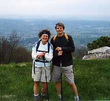
Kate's Mountain loop hike in Greenbrier State Forest, West Virginia. 8.9 miles.

With time off the week after Christmas, we snuck over to Greenbrier County, W.Va., for two days of hiking built around a stay at the General Lewis Inn.

The first day's hike began in the otherwise-empty state forest camping and parking area with a climb of about 1,000 feet up Kate's Mountain. At the ridge line, the trail becomes wide, level and non-rocky as it makes its way along an old forest road. Here, in winter, are good views in both directions off the ridge, especially to the east for perhaps half a mile, where all the trees were taken out – in 2006 – after a pervasive gypsy moth infestation. The Greatest Day Hiker Of Them All, without being aware of it, took advantage of the easy walking to step up her pace on a coolish day, and get us to the high point of Kate's Mountain, at 3,200 feet, well ahead of my expected time. The day was cooler than predicted – about 40 at lunch time – and so we moved off the true peak and its shadows and into a meadow where we could take full advantage of the sun.

From that high point, the trail plummets in what Leonard Adkins describes in his book "50 Hikes In West Virginia" as "one of the longest and most unrelenting steep descents in the state." Indeed, the trail eschews switchbacks in favor of an angle of walk that has you using tree limbs, when available, for braking. We agreed that Leonard's recommendation for the direction of this loop was entirely correct. Think of those two short, steep spots in the Andy Layne Trail and multiply that by, what, 10? It'd be all but impossible to go up. The Day Hiker admitted to no ill effects at the end of the descent, while I was pleased that the reaction in my legs was in the thighs rather than the knees.

The rest of the walk – back into the more-used area of the state forest – is again gentle and easy. And toward the end, near the superintendent's cabin, we did find people, in the form of a person in the gift shop. Gail told her about what she'd seen near the high point of Kate's Mountain, where there is an overlook down onto I-64: two dead dogs, wrapped in a sheet, just down the hill from the forest road.

"Oh, we get a lot of that," the young lady said, and went back to her book.

The warm and cozy General Lewis Inn features antiquey rooms so uniquely appointed that the doors are left open when they're unoccupied, so that guests can walk in and take a look. We enjoyed a pleasant dinner and carefully appointed breakfast (warm maple syrup for the hotcakes and a choice of apple butter or berry marmalade for the toast, for example) at the inn, as well as sitting by the fire in the evening and perusing the old Appalachian implements on display.

December 30, 2008. Lake Sherwood loop trail. 10.9 miles.


This is a terrific hike, in a remote and beautiful part of the Monongahela National Forest. The walk begins near the southern end of Lake Sherwood, which on this cool, clear day was as blue as a lake gets. The trail parallels the shore for a quarter mile or so and then quickly deflates the hope that it is a natural water body when you cross the wide and sun-warmed earthen dam, which provides great views across the water. The trail then makes its way up the mountainside to the Allegheny Mountain Trail, which straddles the Virginia/West Virginia border and follows the undulation pattern of so many Virginia ridgelines. There are winter views into both states, with the Virginia one defined by an ability to keep your eye on Lake Moomaw – from several different perspectives – for more than an hour.

Our pace was so much slower than the day before that we began to wonder, soon before we found it, if we'd missed the end of the Allegheny Trail. With a coldish breeze from the west, we made our way back up the mountain a short distance to a point where we could perch ourselves on the east side and in full sunshine for lunch. We ate without gloves and with a great view onto Moomaw.

The return part of the loop, along the Meadow Creek Trail, provides a completely different milieu than the windy, open ridgeline of the mountain. Rhododendron and mountain laurel crowd the trail even in winter as the pathway snakes along the creek, making 10 rock-hop crossings on its gentle descent to the northern end of the lake. Along this section, The Day Hiker, with little else to command her attention on the ground, became fascinated with the great number of plastic blue-diamond trail blazes that had been detached from trees and laid in the trail. Some appeared to have teeth marks, leading her to wonder if an animal had pulled them out. Some showed no marks, as if the two nails had simply been pried out. Simple vandalism seemed most likely to me, though why would most have been placed so carefully at the base of the tree from which they'd been removed? Eco-vandalism? we wondered.

The last two-plus miles of this walk are along the eastern edge of the lake – yet another new environment. The Day Hiker paused to listen to the sound of water lapping over a rock, and asserted that that noise, with its links to her childhood experiences at a lake in Michigan, was perhaps her favorite in the world. Which made me wonder why, with my own set of childhood adventures in living on a tiny finger of the upper reaches of the Chesapeake Bay, the sound doesn't have any particular magic for me. I told Gail it might rank in the 80s for me, but maybe that's a bit exaggerated. Let's see: The sound of a baseball coming off the bat in your hands is a good one; or the sound of the same ball stopping with a slap against the glove on your hand. The opening double-organ power of Procol Harum's "Repent Walpurgis"... oh wait, maybe it's only fair to stay with natural, outside sounds. Well, that moves the water-lap up quite a bit – up there near (but not all the way to) that faint, is-it-really-there ring in the air when a good strong snowfall is taking hold.

Our hikes are almost always augmented by a map and narrative information about the route and the area. For these two, as with many others in the past, the presence of the terrific work of Leonard Adkins provided us with rich and deep contexts for the day. Leonard's precision with the turn-by-turn details of the walks is keenly valuable in areas such as these where there are multiple trails and sometimes minimal signs. His observations on the natural world and of the history of the area combine with that practical information to provide an invaluably wise and trusty companion-in-absentia in the woods.