Monday, April 27, 2009

Summiting Terrapin Mountain, and Rock-hopping with a Nervous Puppy


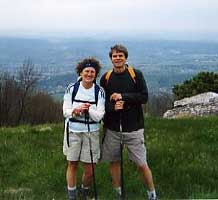
April 11, 2009. Terrapin Mountain Trail/Reed Creek Trail loop. 9 miles.

We'd been trying to get back to this hike – done years ago and only vaguely remembered – for weeks, owing to Gail's hope to pass by the old homeplace of a friend/co-worker who grew up on the side of Terrapin Mountain, in Bedford County. Alas, the little piece of paper with the directions to it were remembered only after some miles of driving into Bedford County, so we'll get to go back to this pesky down-up hike again sometime before too long.

Actually the walk starts up, for perhaps a quarter mile, to reach the summit of Terrapin Mountain before beginning a long, rocky, occasionally steep descent. At the end of the nearly three mile drop, the Terrapin Mountain Trail intersects with the Reed Creek Trail, and things get considerably easier; the trail makes its away gently along near the bottom of the mountain, curling its way around and into ravines on its way to Reed Creek.

We ate along one of the bends, in the semi-sunshine on a rock. (And found out, a day or so later, what we have had to relearn every daggone year in the woods: It gets to be April? And warm? You need to get the trusty ground cover out and sit on it for lunch, or else – come Sunday or Monday – you'll have these big ol' itchy welts on your backside. Duh.)

It was at the first crossing of Reed Creek, on this spring day when the water was spilling furiously over the rocks, that we had our adventure for the day. Gail and I had to walk upstream a good ways to find a set of rocks, boulders and logs that were close enough together to let us hop across. But alas, puppy Cookie – seven and a half months old and a fine leaper on dry land – wanted no part of the last boulder-to-rock jump. And so we scouted farther up but to no avail, with the dog yelping more and more desperately with each passing, separated-from-momma moment. At last, back where the trail crosses on small rocks at lower water levels, The Greatest Puppy Helper took off her shoes to wade the dog across. Halfway, with the woman yelping from the cold and the dog from fright, Cookie wrestled her way out of her collar rather than go into water well onto her belly. The second try, with the collar tighter, was a success, and the little half-hour challenge was done.

The trail turns, a half mile or so up, across the stream again. And while we did have to scout a bit again, we soon found a crossing all three could readily make. From there, it was on up the rest of the mountain back to the starting point, on what is, despite its climb-at-the-wrong-time, a nifty walk.

Tuesday, April 21, 2009

Honoring Wilderness, and Audie Murphy


April 4, 2009. Appalachian Trail, Va. 620 to Audie Murphy Monument and back. 7.6 miles.

We picked this walk on this day in honor the signing by the president of the omnibus outdoors bill, which includes the creation of a new designated wilderness along its route – Brush Mountain East. The new protected area is one of seven new wildernesses bought into being by the Virginia Ridge and Valley Act, which protects 43,000 acres as wilderness, and also creates more than 10,000 acres in two new National Scenic Areas in Virginia. That bill, versions of which go back as far as 2004, was sponsored by both Senators Webb and Warner in the Senate and had sponsorship or contributions from Representatives Goodlatte and Boucher in the House.

The good climb up from the low point at Trout Creek along 620 was of course no less steep by virtue of the new designation, but the approach from this direction does get you on the ridge line sooner than from the other way up, allowing for a pleasant and easy second half of the walk to lunch.

The monument to the fallen war hero is more decorated every time we visit it, with more and more intricate cairn work off to the side, and more and more flowers (artificial for sturdiness), flags and other leave-behinds all around the stone marker. We scouted around for the perfect lunch spot on both the east and west sides of the ridge and ended up, as is The Day Hiker's wont, on the east – in the sun and not in the wind. Frisky puppy Cookie was tired enough to allow us a brief nap before we started back through the woods with just a touch of new meaning to them.

Wednesday, April 1, 2009

Following in Thomas Jefferson's Footsteps


March 29, 2009. From Blue Ridge Parkway milepost 83.1: Fallingwater Cascades Trail loop and Flat Top Mountain up and back. 7.2 miles.

This two-walk walk is a good one for an early-spring, post-rain trek, given the presence of falling water, moist spots for early wildflowers and the open, pre-leaf views going up 4,001-foot Flat Top.

All three perspectives provided at least some reward on this brisk, increasingly blue-sky day. The falls had a healthy, noisy flow. The Greatest Day Hiker Of Them All paused maybe 20 times during the walk to move leaves, inspect new shoots and occasionally quiz her hiking companion, who was maybe-two-of five on identifying. And on the way up, views onto Harkening Hill to the west and out onto the piedmont to the east were frequent.

The walk up the mountain that the AT guidebook talks about Thomas Jefferson climbing at age 72 is a rewarding one – nicely switch-backed till near the top, where things get rocky and steep, and where there are several faux summits before you reach the terrific views from both the western and eastern rock outcrops at the true summit. One of those false summits was recommended to us pre-hike by son Carl, whose propensity toward photographic memory for hikes manifested itself with the advice to look out for Pinnacle Rock and its gnarly old evergreen, which we did find.

At the true summit, The Day Hiker and her rock-rookie puppy headed immediately for the eastern overlook; I took a quick view westward before joining them on the eastern overlook, where we were surprised to have the big rock to ourselves on this pretty day. Cookie explored it to every edge and precipice, causing her mistress to reach the edge of panic several times.

The air was sufficiently clear to see the city of Bedford fairly clearly. The Bedford reservoir is the most immediate and prominent feature of the view. To the north, Apple Orchard Mountain is prominent, and to the south, Sharp Top's sharp, rocky top is clear and imposing (though about 125 feet shorter in elevation than Flat Top).

On the walk back down, six-month-old Cookie confirmed her readiness for full-distance hikes with a sustained friskiness that manifested itself in off-trail runs and explorations, and in a half-mile or so of repeated taking of Gail's hiking pole into her mouth, to the extent that for many steps at a time, the pole served as sort of a stiff, voluntary leash for the wacky puppy.